

From the youngest to the oldest inhabitant, a friendly, caring community is the essence of Austrey! Villagers say hello or good morning as they walk around the village and quite often stop for a chat; the village shop and local pub are a great place for a gossip. Many villagers are involved with one or more of the organisations listed on the website. This enables newcomers to meet new people and become part of Austrey's thriving community.
Austrey is situated at the northern most point of Warwickshire and is within a short distance of the borders of Staffordshire, Derbyshire and Leicestershire. It lies mid-way between Tamworth in Staffordshire and Ashby-de-la-Zouch in Leicestershire. Close by are the National Forest and the Bosworth Field where in 1485 King Richard III was killed.
The Domesday Book lists the village as Adulvestrev and it was formerly known as Adulestry or Adulfe’s Tree and at the time of the Domesday survey the population was noted as 40 villagers and a priest, making Adulvestrev one of the biggest villages in the region. The population of the village trebled in size over the last half of the twentieth century. There were just over 300 people and 124 houses at the start of the twentieth century and this increased to around 1000 people and over 300 houses by the year 2000.
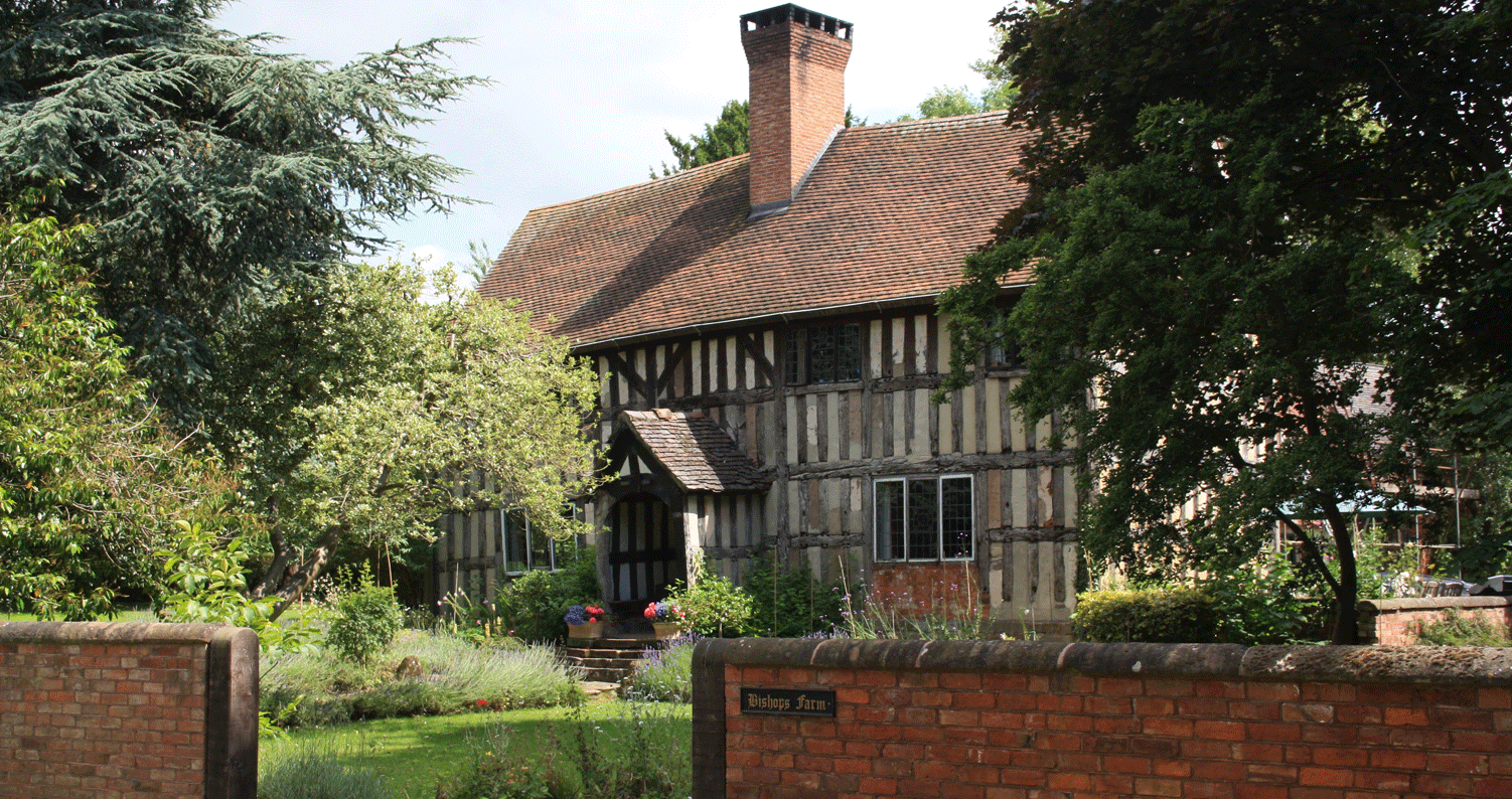
Very few houses remain of the original village, among them are a half timbered property known as the Farthings, which was originally the village shop and post office, on the front wall there is a disused post box. The telephone box next to the Farthings is a listed building. Other properties include Bishops Farm a black and white half-timbered property, and opposite is Manor House a large impressive three-storey building. There are farms still located within the village, but many have been sold to provide land for the current housing.
Warton Lane was the main through road for the village with farm land to the south, this land has been developed over the last quarter of the twentieth century, with Bishops Cleeve being the route from the village of Warton into the centre of Austrey.
There are two churches in Austrey, the Baptist Church built in 1808 and St. Nicholas’ Church dating back to the 13th century. It was this church that built the original village school in 1850 and it was in use as a school until 1969 when Warwickshire County Council decided to build a new school at the other end of the village. The old school has been used as a village hall since that time and is in regular use by different organisations. There used to be a small brewery with a pub attached to it in the village, but these have long gone and the only pub now is next to the church and is the only thatched roof building in the village. Outside the Bird in Hand pub stands a medieval plinth thought to have been where a local market was held, and there are records of a market cross on this site around the 1300’s.
A series of ancient hedgerows delineated the boundary of Austrey and although many fields have been combined to form larger tracks of land, originally they were probably where the different farmers ploughed the wasteland to grow crops. The old shire boundary between Warwickshire and Leicestershire was important as it also marked the boundary between the dioceses.
This was important for the villagers of Austrey as it marked out the collection area for church tithes and gave a strong sense of parochial identity. Austrey was mainly a farming area and although mixed farming was well established by the late medieval period, the land was generally farmed for subsistence, meeting feudal obligations to the landowners, one of whom was the Earl Ferrers, and most probably to the monks of Burton who had been granted rights to the parish.
Our appreciation is given to Alan Roberts for his work and contribution to this site.